What is a DigiTwin?
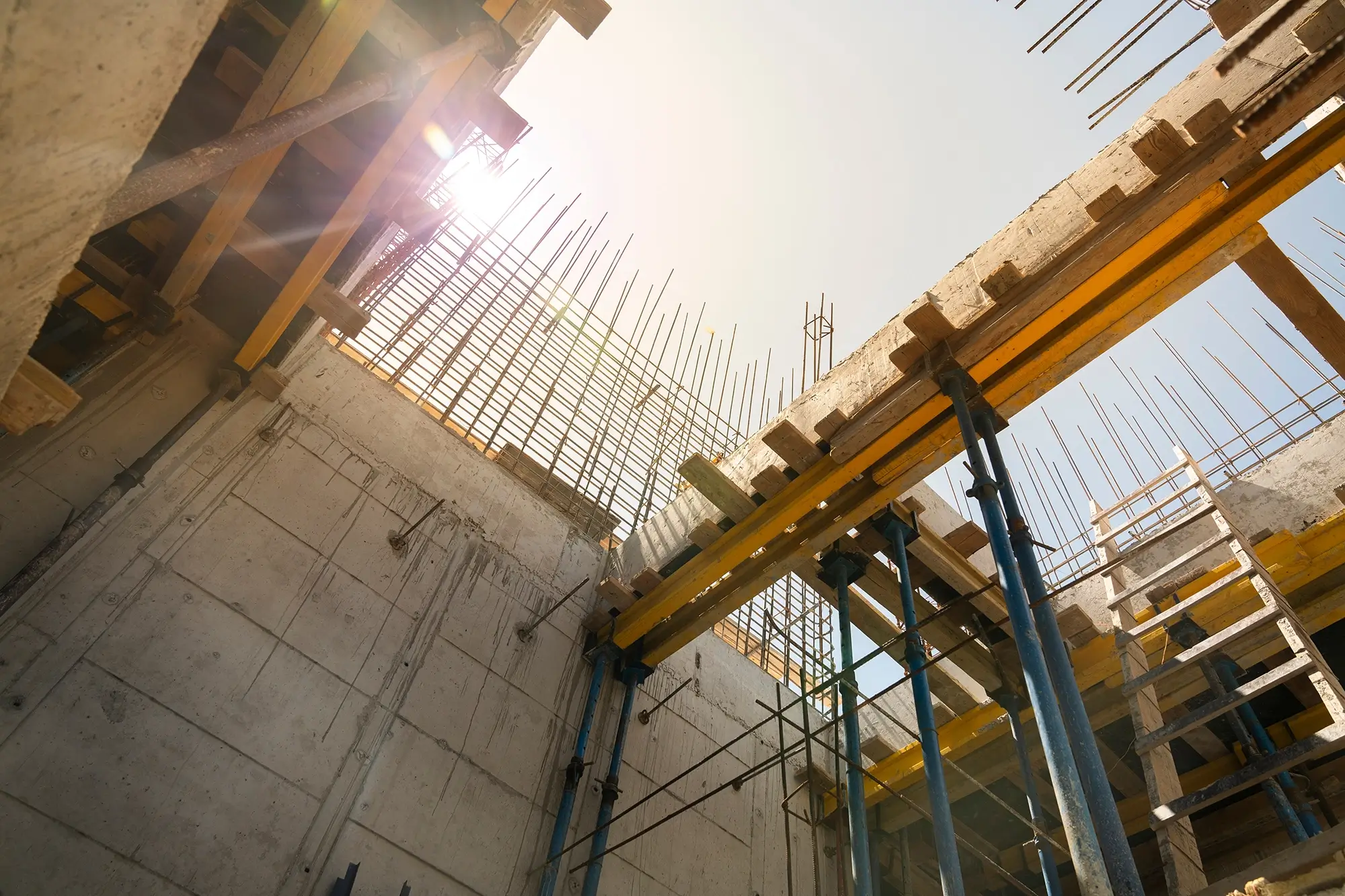
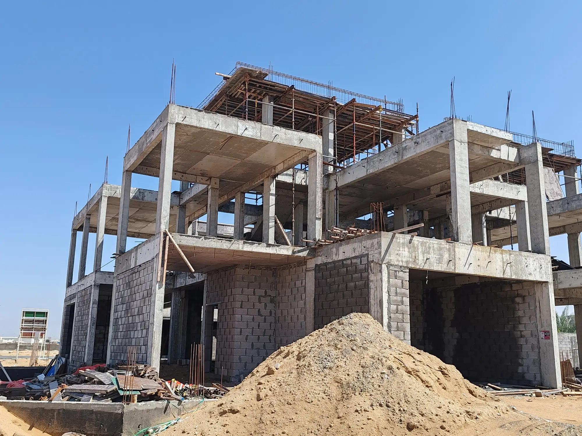
Reality capture of your development Project
Powerful Data at your Fingertips
Available on Mobile, Tablet and Laptop, your DigiTwin offers you a comprehensive site overview that is measurable in real time! Empower your team with the latest up-to-date site data and analytics.
One Login.
Full Visibility.
Monitor multiple sites and locations from anywhere – even the other side of the world.
Reduce travel costs and improve visibility, all with one login.
DigiTwin Features
Our APPROACH
Better Inspections,
Less mistakes…
Better known as SAI Drones, we create construction site DigiTwins for Builders and Property Developers. SAI Drones’ winning combination of market leading hardware and cutting edge software combine to deliver the perfect reality capture to create your project’s perfect Digital Twin.
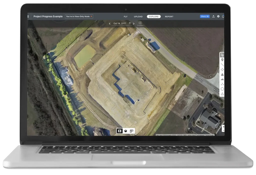
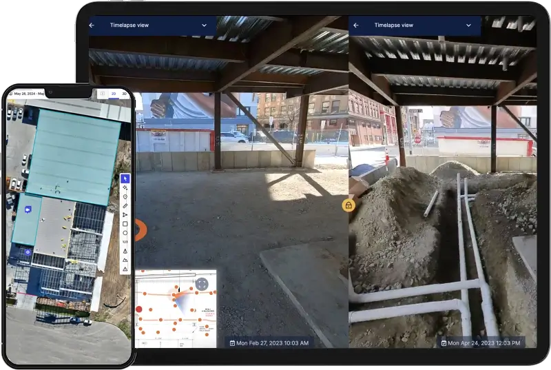
Mobile Platform Viewing
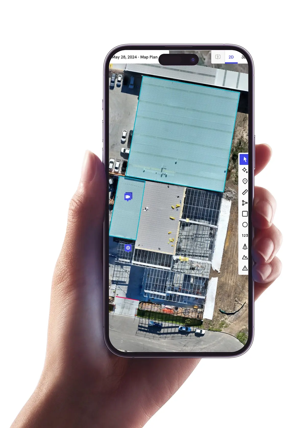
View all your current and past projects in the palm of your hand! From Highly Detailed and Accurate 2D Orthomosaic maps, to 4K Video and UHD aerial photography, it is all available on your mobile or tablet device.
View your projects on your Mac or PC for even more features including 3D Models and timeline comparisons!
You can even gain efficiencies by sharing real time access of your DigiTwin with your team and key construction partners.
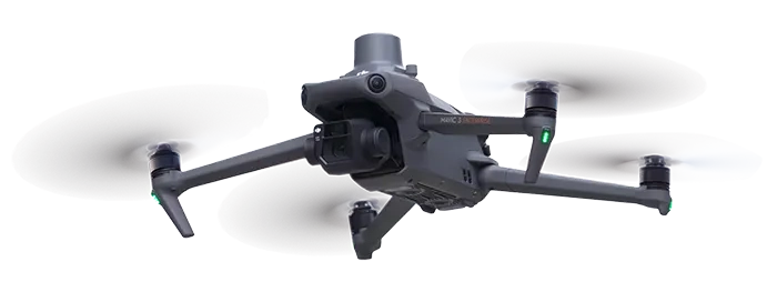
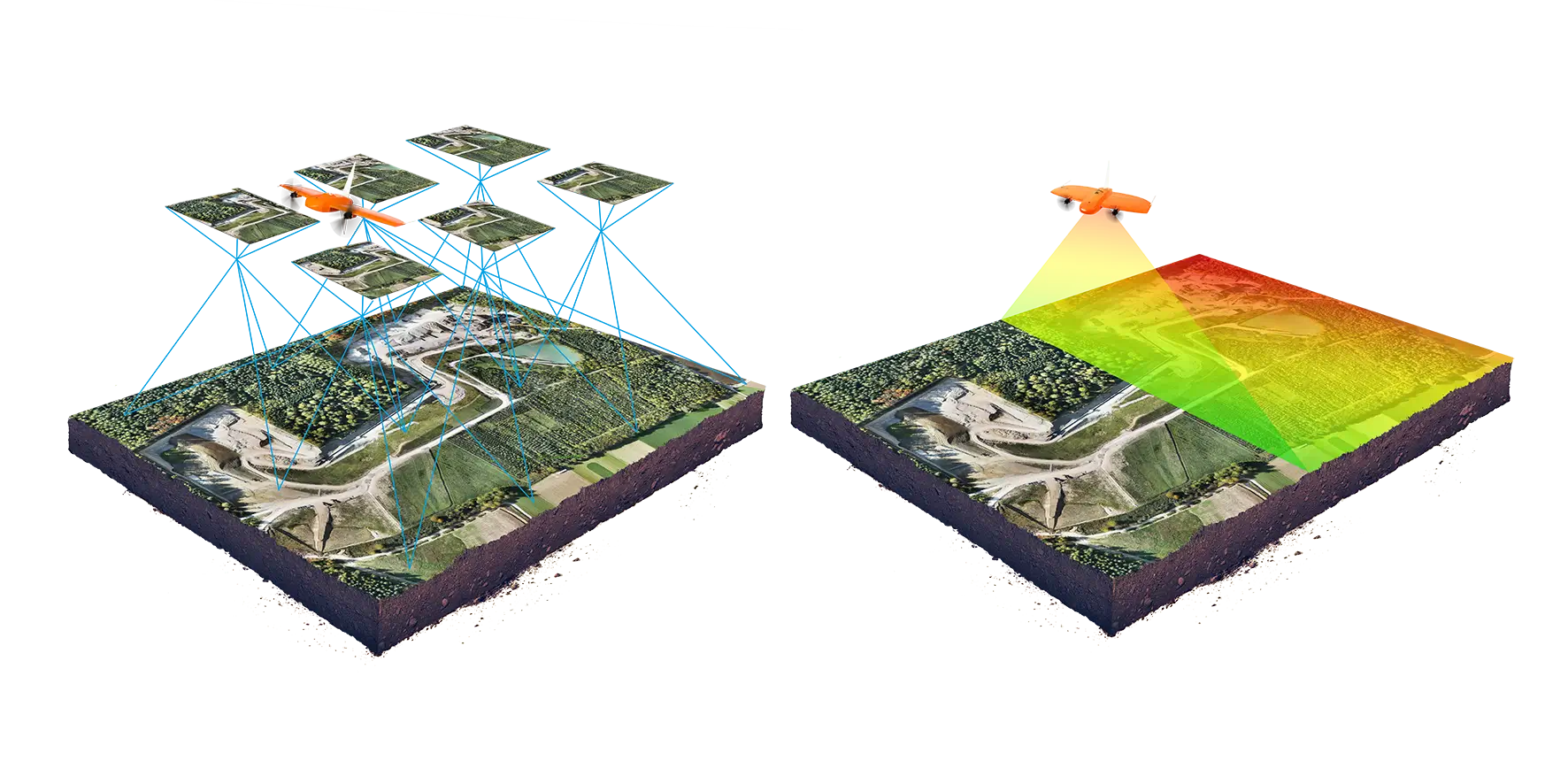
RTK Accurate Mapping
Our Fleet of “RTK” or Real-Time Kinematic enabled Drones provide significant accuracy enhancements, allowing our Drones to calculate their exact geo-referenced position down to +/- 10mm. This allows Sydney Aerial Innovations to offer survey grade mapping solutions for a fraction of the price and in a fraction of the time.
Included with your DigiTwin
2D Orthomosaic Site Maps
Unlock the future of construction with Sydney Aerial Innovations. Our advanced photogrammetry technology creates highly detailed and precise site maps for builders and property developers, down to an impressive accuracy of 10mm. Elevate your development’s virtual experience with our cutting-edge solutions.
3D Models
Discover the power of precision with Sydney Aerial Innovations! Our cutting-edge photogrammetry technology delivers incredibly accurate 3D models for builders and developers to elevate their construction projects. By capturing every detail from above, we create virtual experiences that bring your vision to life like never before. Let us revolutionize your development process today.
Aerial Photography
Enhance your construction journey with Sydney Aerial Innovations’ immersive aerial solutions. See your projects from a whole new perspective and unlock the future of precision and accuracy. Let’s elevate your development experience together!
4K Aerial Videos
Elevate your construction projects with Sydney Aerial Innovations’ high-resolution 4K videos of your site, capturing every detail with precision. From immersive 360-degree panning videos to dynamic hyperlapse and timelapse content, our aerial videography services bring a new perspective to your development journey. Let us showcase your project in a way that truly sets you apart in the industry.
Internal 360 pics & walkthrough
Let’s bring your construction projects to new heights. Step into the future of precision and innovation with Sydney Aerial Innovations. Our cutting-edge solutions redefine virtual experiences, providing unmatched accuracy and detail. Elevate your development to extraordinary levels today!
Historical Record of Construction (HRC)
Introducing the ultimate solution for your construction needs – the Full DigiTwin HRC Package from Sydney Aerial Innovations. This package combines multiple DigiTwins over time to build the Historical Record of Construction that will revolutionize the way you approach your development projects. Elevate your virtual experience with unmatched precision and innovation.
About us
Sydney Aerial Innovations
Better known as SAI Drones, we create construction site DigiTwins for Builders and Property Developers. SAI Drones’ winning combination of market leading hardware and cutting edge software combine to deliver the perfect reality capture to create your project’s perfect Digital Twin.